Weather instability peaks in Greece as storms and strong winds forecast

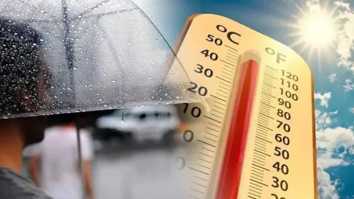
Weather instability is expected to peak across Greece on Wednesday as cooler air masses moving through the upper atmosphere interact with the warmer conditions that have dominated the country in recent days, meteorologists said.
The unsettled weather is forecast to continue into Thursday, although over a smaller geographical area, while the seasonal northerly meltemi winds are expected to gradually strengthen across the Aegean Sea.
According to ERT meteorologist Olga Papavgouli, Wednesday began with increased cloud cover, particularly over northern and central Greece, where rain and thunderstorms were already developing. Clouds are expected to spread southward as the day progresses.
Strong storms and possible hail
Showers and thunderstorms are forecast across many mainland regions, with some storms expected to be locally intense and accompanied by hail.
The strongest weather activity is expected along the Pindus mountain range, particularly in Thessaly and Central Greece, as well as in parts of Macedonia and the mountainous areas of the Peloponnese. Storms are likely to persist in northern Greece during the evening hours.
Meteorologists said the heat accumulated over previous days could contribute to the development of stronger storm systems and localized hailstorms.
In the Attica region, brief showers or isolated thunderstorms are possible during the afternoon, mainly in western and northwestern areas near Mount Parnitha and Mount Kithairon.
Winds have shifted to northerly directions and are expected to reach 3 to 5 Beaufort, increasing locally to 6 Beaufort in the Aegean.
Temperatures are forecast to fall slightly across central and northern Greece due to increased cloud cover and rainfall, with highs ranging between 30C and 32C. Southern areas are expected to remain warmer, with temperatures reaching 33C to 34C.
Thursday is expected to be a transitional day as weather instability gradually weakens and northerly winds strengthen.
Scattered showers and thunderstorms are forecast, mainly in the Peloponnese, Central Greece, Central and Eastern Macedonia, and Thrace. The most significant weather activity is expected in the Peloponnese.
Winds in the Aegean are forecast to strengthen to 6 to 7 Beaufort, bringing drier air and helping to reduce atmospheric instability across much of the country.
Temperatures will remain close to seasonal averages, reaching 31C to 32C in eastern regions and up to 34C elsewhere.
Fire risk to increase from Friday
Forecasters expect a further strengthening of meltemi winds on Friday, with gusts reaching up to 8 Beaufort in parts of the central and southern Aegean, particularly around the Cyclades.
The stronger northerly winds are expected to significantly reduce weather instability, limiting rainfall mainly to isolated showers in mountainous inland areas.
However, authorities are warning that the combination of strong winds and dry vegetation will substantially increase the risk of wildfires, particularly across eastern parts of the country.
Temperatures in eastern Greece will remain near seasonal norms, generally between 30C and 31C, while western regions could see temperatures rise locally to 34C or 35C due to downslope warming effects along the western slopes of the Pindus mountains.
Weekend outlook
Weather conditions are expected to stabilize further over the weekend, with only limited instability remaining in northern Greece.
Strong meltemi winds will remain the dominant feature across the Aegean on both Saturday and Sunday, while temperatures are expected to rise slightly in western parts of the country.
Meteorologists warned that Friday through Sunday will mark the first period of significantly elevated wildfire risk this summer, with persistent northerly winds expected across large parts of eastern Greece.
Residents and visitors are being urged to exercise caution, particularly in areas with dry vegetation and high fire danger.
Source:ERTNews