Weather shift expected: Two-day spell of storms, hail and thunder across Greece

A new wave of unstable weather is expected to affect Greece in the coming days, bringing showers, thunderstorms, hail and lightning activity, according to meteorologist Klearchos Marousakis.
The system is forecast to develop from Tuesday afternoon, initially affecting inland mainland areas and the Peloponnese, where cloud build-up is expected to trigger localised showers and thunderstorms.
Stronger storms midweek with hail risk
Weather instability is expected to intensify on Wednesday and Thursday, with more organised afternoon storm activity across much of the mainland. Forecasters warn that storms may be accompanied by hail, particularly during peak daytime heating hours.
Authorities also caution about the potential for intense lightning activity and localised flooding due to heavy rainfall in short periods.
Winds to fluctuate, fire risk expected to rise
The Meltemi winds over the Aegean Sea will continue with varying intensity throughout the week. Winds are expected to ease temporarily on Wednesday and Thursday, before strengthening again from Friday, with gusts reaching up to 8 Beaufort.
This increase in wind intensity is expected to raise wildfire risk in vulnerable regions.
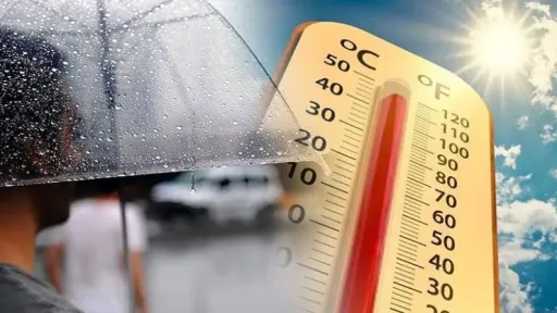
Temperatures remain high despite instability
Despite the unsettled conditions, temperatures will remain relatively high, generally ranging between 33C and 35C. In western mainland areas, temperatures may reach up to 37C, including regions such as Agrinio, Arta, Patras, Kalamata, and southern Crete.
Elsewhere, temperatures are expected to stay closer to 28–30C.
Mixed weather pattern continues
The combination of heat, strong winds, and atmospheric instability is expected to create volatile conditions, with risks of thunderstorms, hail, and sudden localised flooding episodes across parts of the country.